
"The planet's densest carbon, on the coast."
Mangroves store carbon in biomass and waterlogged soils at densities far above most forests — the highest-value "blue carbon" — while protecting coastlines and fisheries. We map and verify it from satellite.
Mangroves lock carbon not just in their biomass but in deep, waterlogged soils where it can remain stable for over a thousand years — storing carbon at 3–5× the density of typical terrestrial forest.
Restoring and protecting them delivers carbon removal, coastal resilience and richer fisheries all at once — making mangrove blue carbon among the highest-integrity nature-based credits.

Delineate mangrove canopy and area from high-resolution satellite imagery.
Quantify above- and below-ground carbon stocks across the mapped area.
Track restoration, survival and canopy change season over season.
High-integrity blue-carbon credits with a transparent evidence trail.
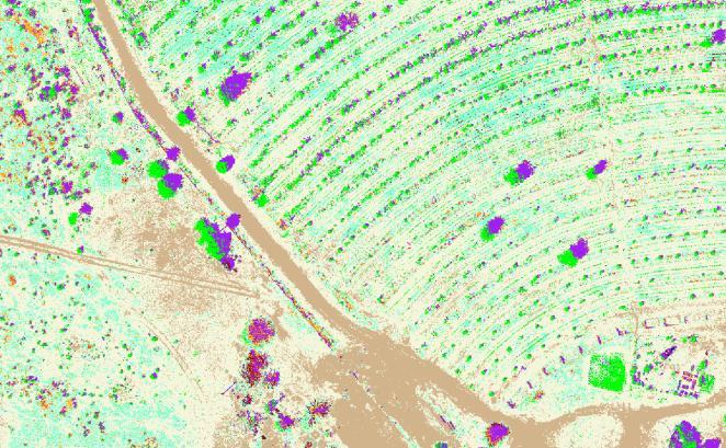
Repeat satellite passes detect canopy cover, density and change — so restoration is verified objectively rather than by sampling a few plots.
Verra’s VM0033 (v2.1), the Methodology for Tidal Wetland and Seagrass Restoration, is the route most mangrove projects take. It applies globally and covers tidal forests — mangroves — alongside tidal marshes and seagrass meadows.
What it credits is restoration of the conditions the ecosystem needs: hydrology, sediment supply, salinity, water quality and native plant communities. Planting alone is not the intervention; re-establishing the system that keeps the planting alive is.
Its carbon pools are where mangroves differ from any forest above ground. VM0033 accounts for above- and below-ground biomass, soil organic carbon, and in some cases wood products. For strata on organic soil it asks for peat depletion time (PDT); for mineral soils and sediments, soil organic carbon depletion time (SDT). The soil is not a footnote to the claim — it is most of it.
That is why canopy alone cannot carry a mangrove credit, and why the co-benefits a coastal programme is usually funded for — flood protection, water quality, habitat for marine life — sit alongside the carbon rather than instead of it.
Carbon captured and stored by coastal and marine ecosystems — mangroves, tidal marshes and seagrass meadows. What sets it apart from forest carbon is where it sits: most of it is in waterlogged soil rather than in standing trees, and that soil can hold it for millennia as long as it stays wet and undisturbed.
Verra’s VM0033, the Methodology for Tidal Wetland and Seagrass Restoration, currently at v2.1. It covers tidal forests such as mangroves along with tidal marshes and seagrass, and it credits restoration of hydrology, sediment supply, salinity, water quality and native plant communities.
Because it is the larger pool. VM0033 accounts for above- and below-ground biomass and soil organic carbon, and for soil it asks a project to work out depletion timing — peat depletion time on organic soils, soil organic carbon depletion time on mineral soils and sediments. A project that measures only what is visible above the waterline has measured the smaller half.
No, and it is worth being direct about that. Satellite carries canopy, extent and change over time very well, across coastline that field teams cannot practically walk. It cannot tell you what is in the soil. A credible mangrove programme pairs the remote layer with sampling, and keeps both against the same strata.
From baseline mapping to restoration monitoring, we'll quantify it with confidence.
Why the majority of the stock sits below the water line, and what a project has to show before a credit is issued.
7 min read →How a digital measurement workflow closes the data gap, from the first field measurement through to credit issuance.
6 min read →Boundaries that do not match the ground, photographs without provenance, duplicate enrolments — and what prevents each of them.
7 min read →